The Bureau of Reclamation announced in an August 13 news release that flows on the South Fork Boise River will rise to 2,400 cfs for several days to transport sediment in the river and help improve fish habitat.
This action comes after several months planning a response to the August 2013 wildfire which burned much of the SFB watershed, followed by heavy rains September 12, 2013 that caused several debris flows that delivered sediment and debris into the South Fork Boise River. Additional storms this summer have added more material and debris to several locations along the South Fork.

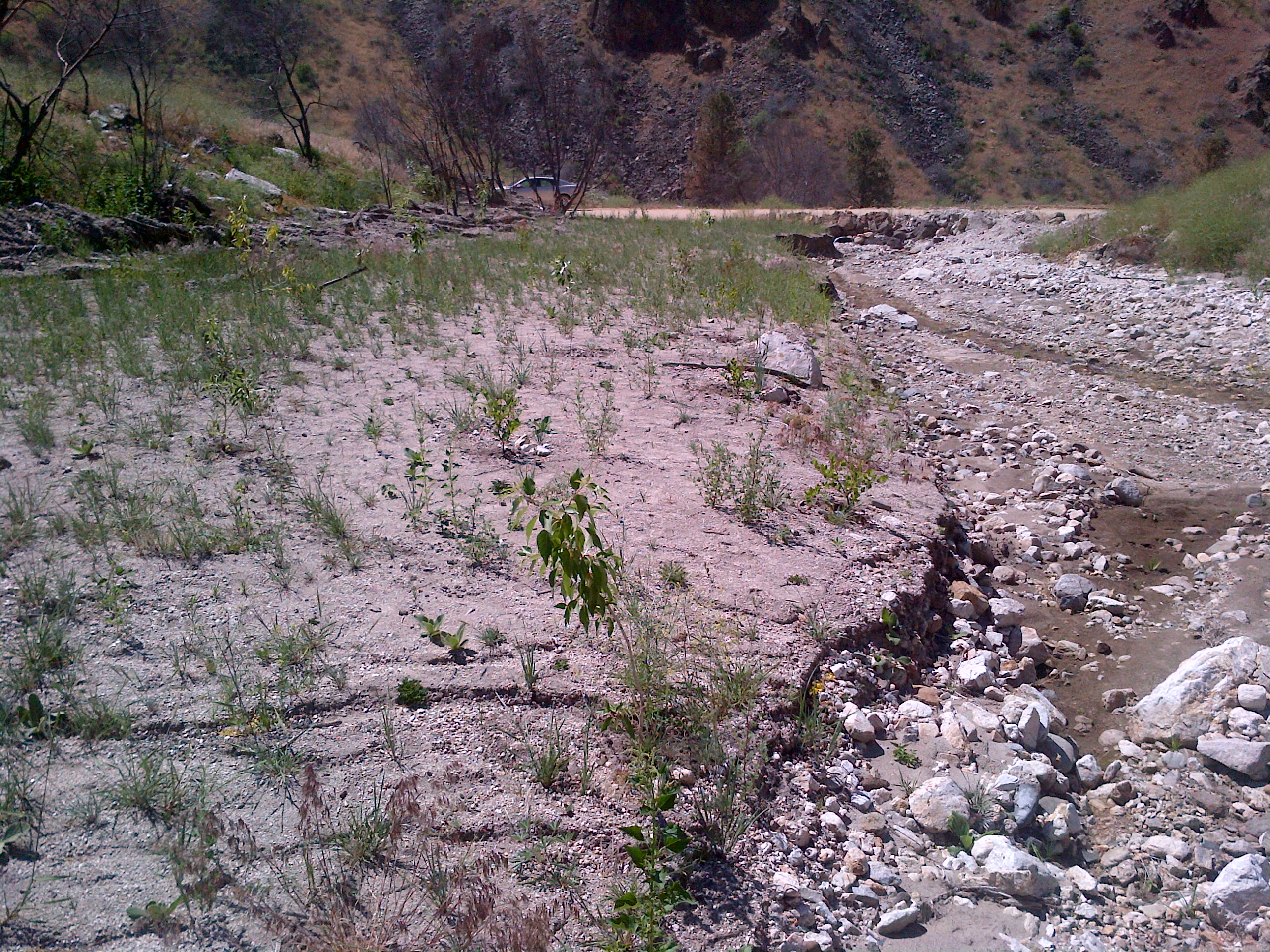
Granite Creek blowout upstream of the South Fork Boise River Road.
A South Fork Boise Recovery Team; including US Forest Service, Trout Unlimited, University of Idaho, Idaho Department of Fish and Game, and U.S. Bureau of Reclamation met and developed flow recommendations and a rationale. Here are some highlights of their information:
Fire and the resulting sediment and debris slides are a natural and regular occurrence in southern Idaho and the Idaho Batholith. In natural systems, fires impact fish populations positively and negatively. In managed systems, impacts may be more or less severe depending on circumstances.
Changes in sediment regimes may be one of the largest changes to stream networks post fire. A tremendous amount of fine sediment was added to the SFBR during these events. Fine sediments affected the quality and quantity of overwintering habitat by filling in side channels and interstitial spaces along the shoreline, these habitat features are critical for the survival of bull trout, rainbow trout, and their prey bases. Reduced quality and quantity of overwintering habitat and spawning habitat for prey fishes affect bull trout. Fisheries surveys in the fall of 2013 and spring of 2014 show reduced numbers of age-0 rainbow trout that will support the future rainbow trout fishery and serve as prey fish for bull trout. In a natural system, these sediment inputs are sorted and transported under naturally occurring high flows during spring snowmelt. In regulated systems, such as the SFBR, high flow events are attenuated to mitigate flood risk and to store water for irrigation (and other uses). The regulated flows result in lower peak flows especially in poor water years or years with low carryover storage like the winter of 2013/2014. During these conditions, less fine sediment is transported leading to longer-term detrimental impacts to bull trout, their habitats, and other aquatic biota.
The multi-agency group held meetings November14, 2013, March 5, May 29, and July 18, 2014. In addition to developing a list of data needs to assess potential responses to mitigate the effects of the fires and resulting debris flows, and discussing results from sediment modeling and recent fish surveys, the team recommended flow shaping to:
- Provide as much stability as possible during the rainbow trout spawning period;
- Provide stability for incubating rainbow trout eggs; and
- Increase reservoir storage, in anticipation that increased storage would enable a flushing pulse that could be used to mobilize fine sediment during the 2014 spring runoff period.
Storage in the Boise River system precluded a flushing event in the late spring as there was little room to store the flushed water in the lower system (Arrowrock and Luck Peak reservoirs). Thus the team “believes that a pulsing flow is an important step to hasten recovery of important fish populations and habitats found within the SFBR. As such, the team reconvened after learning that a spring flush was not possible to update the sediment model and discuss options for a flushing pulse later during the 2014 water year.”
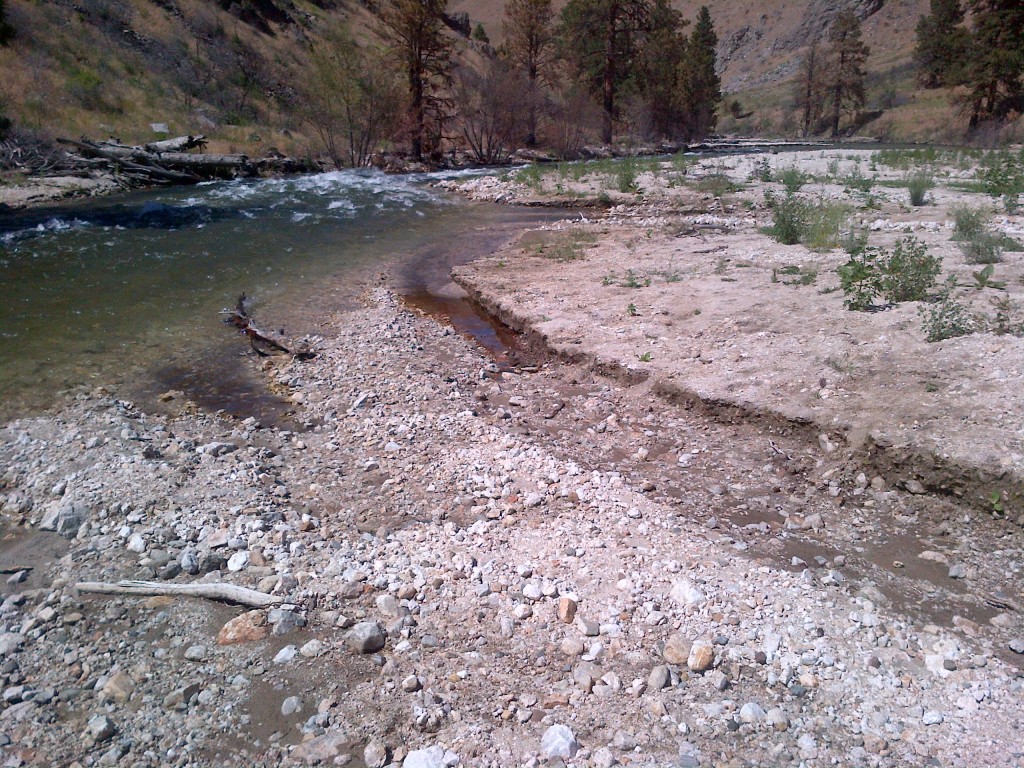
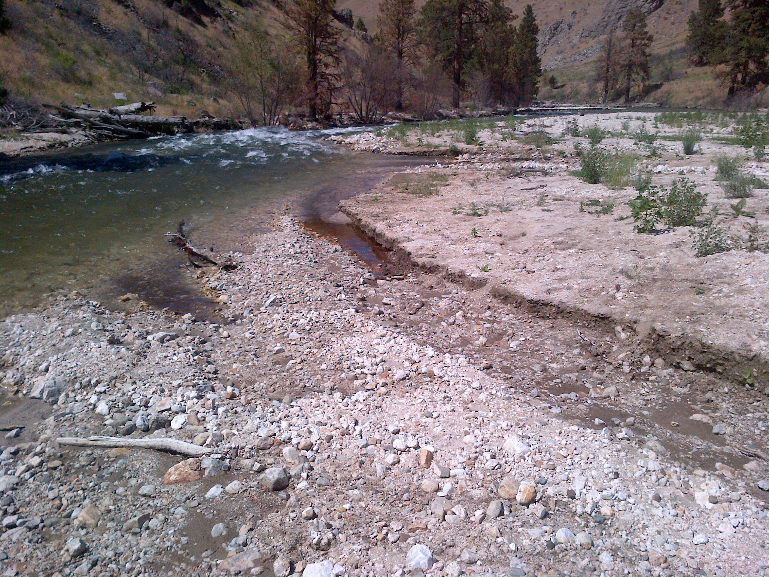
Summer 2014 – South Fork Boise River flows cut a channel through the sediment.
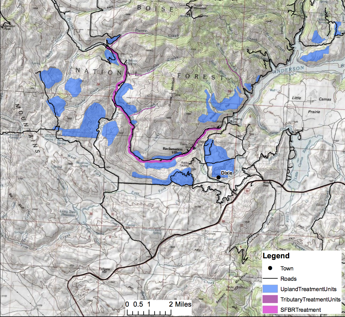
The University of Idaho’s Ecohydraulics group developed a 1 dimensional (1D) coupled hydraulic and sediment transport model of the river from Anderson Ranch Dam Gage to Neal Bridge to simulate sediment transport through the system.
The volume of recently deposited sediment (debris fan) was estimated by field measurements. Five debris fans were identified within 10 miles downstream of Anderson Ranch Dam. The 1D sediment model predicts that size of sediment that will move under certain flow volumes given the channel cross-sectional shape and slope. Sediment particles less than the size used by spawning fishes were considered in the model.
Existing LiDAR DEM data was used to extract cross-sectional depth data to more accurately identify just how deep some of the recently deposited sediment fans are, and to identify where redistribution of sediment would occur. Three
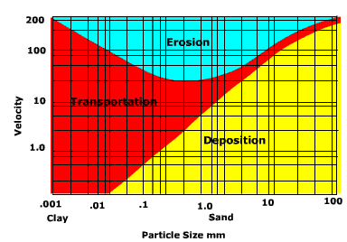
Movement of sediment depends on speed of water and size of sediment particles.
different discharge magnitude and duration scenarios (recommended by the team) were used to investigate total volume of sediment transport from debris fans, upper canyon and canyon sections. Discharge scenarios included a pulse of 2000 cfs for 8 days; 2400 cfs for 8 days; and 3000 cfs for three months.
Sediment transport simulations based on the 1D model showed that the 2014 irrigation flows of 1600 cfs move some sediment but do not erode the debris fans completely. Part of the mobilized sediment is deposited in lower velocity reaches like pools and the remaining sediment remains in transport.
Key findings from latest modeling:
- A flow pulse of 2000 cfs for 8 days does not visibly change the sediment transport.
- A flow pulse of 2400 cfs or greater for 8 days causes a detectable change in the deposition of sediment while improving the quality of both overwintering and spawning habitat.
- Flows in excess of 3000 cfs, sustained for as long as three months will mobilize fine sediments but will not flush them out of the river corridor into Arrowrock Reservoir.
Analysis of potential depositional areas shows that overwintering habitat and spawning reaches should not experience large deposits of fine sediments, improving the quality of both habitat types.
We recommend a flow pulse of at least 2400cfs for a minimum of eight days based on the new results from U of I’s sediment transport model.
The Bureau of Reclamation is required to protect critical habitat for bull trout habitat, thus the water storage levels in both Anderson Ranch and Arrowrock reservoirs require attention during the same time period as the recommended pulsing flows. Neither requirement will be jeopardized as a result of the recommended flow pulse. Furthermore, water used for the flushing pulse (approximately 8,000 acre feet), if stored in Arrowrock Reservoir through November 2014, would provide an additional benefit to migratory bull trout returning to Arrowrock Reservoir.
The flow increase is scheduled to begin Monday the 18th.
 The Elk Complex Wildfire of August 2013 will have long-lasting effects on the lower South Fork Boise River.