News

Summer Impression of Water Flows

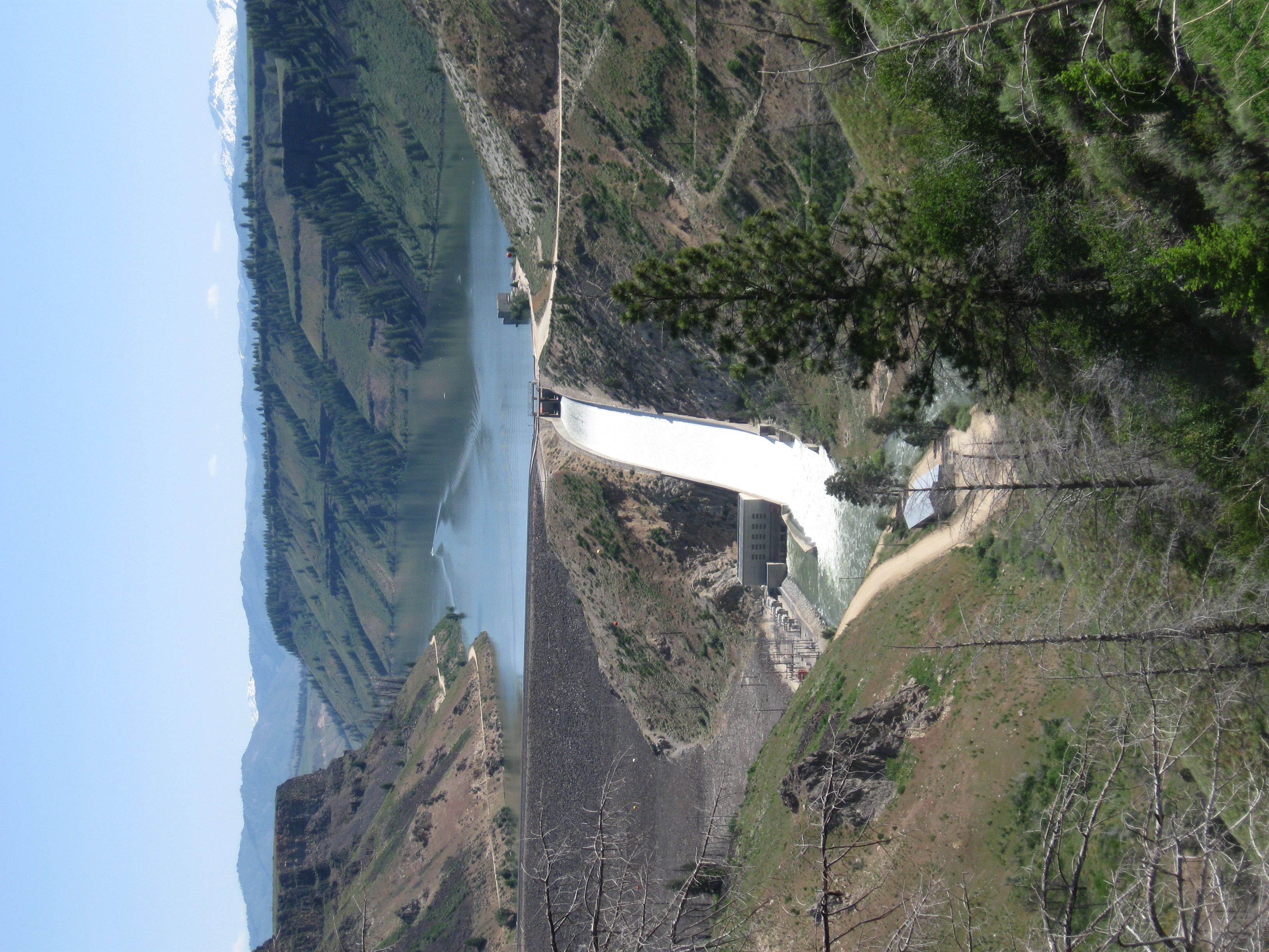
A summer drop in on the South Fork Boise River.  A quick stop or two to observe the status of the river after the very high flows in the spring and early summer and it appears much of the sediment has been moved out.  Check out this photo of the pocket water emerging again before it dumps into the Pine Tree Hole:

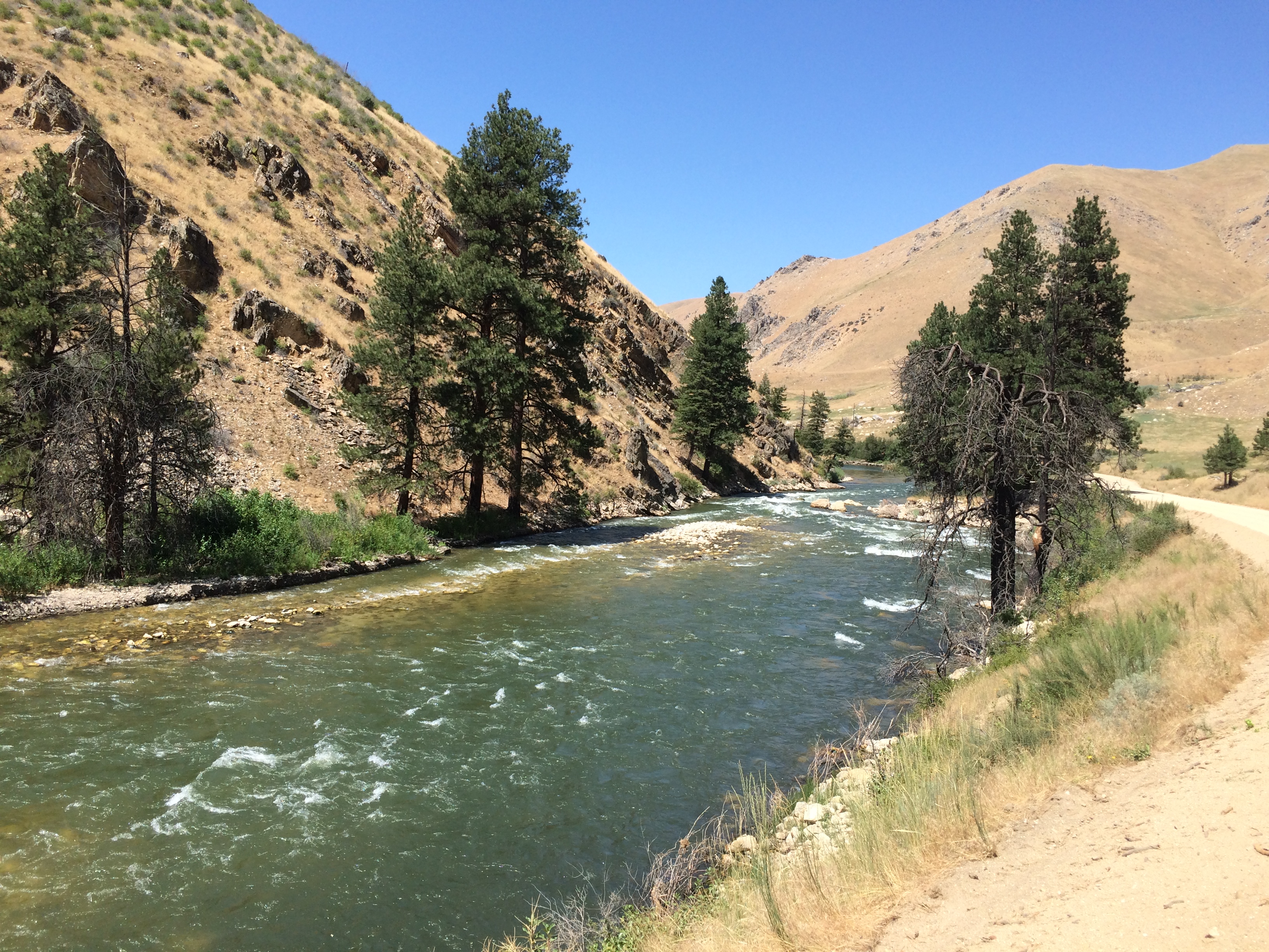
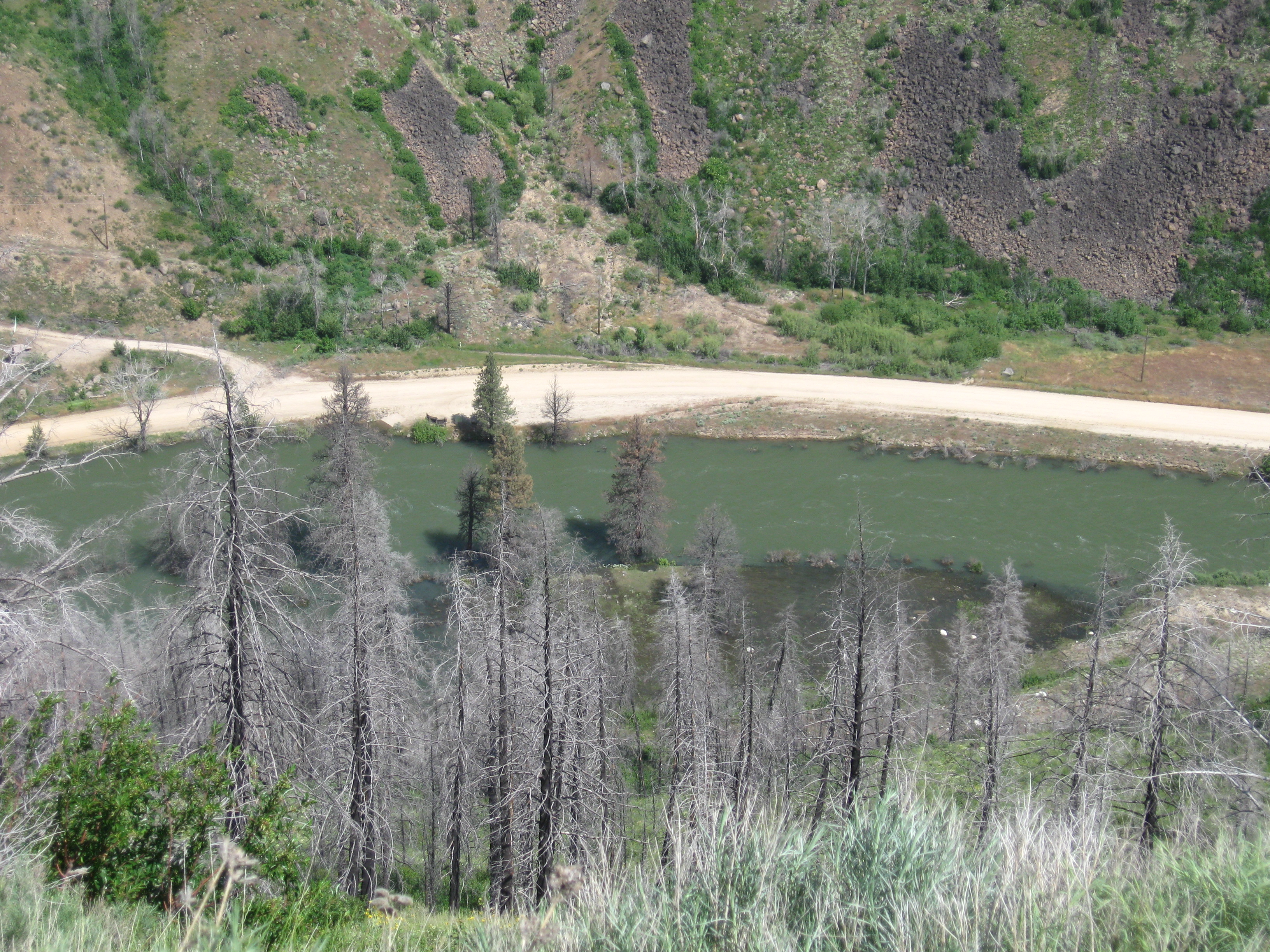
Looking downstream towards the Pine Tree Hole. Early August 2017

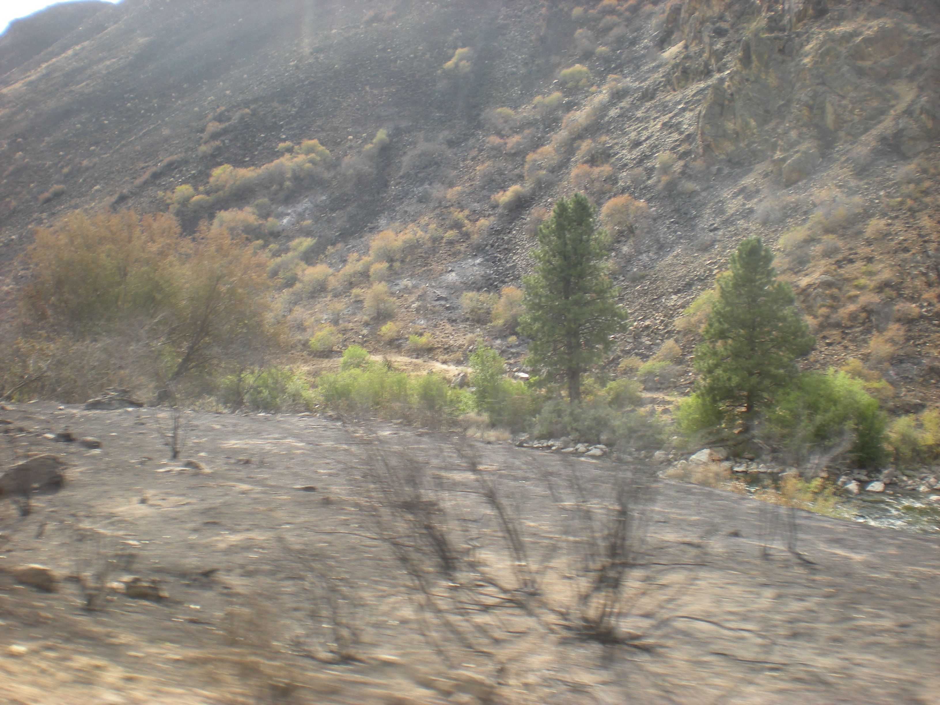
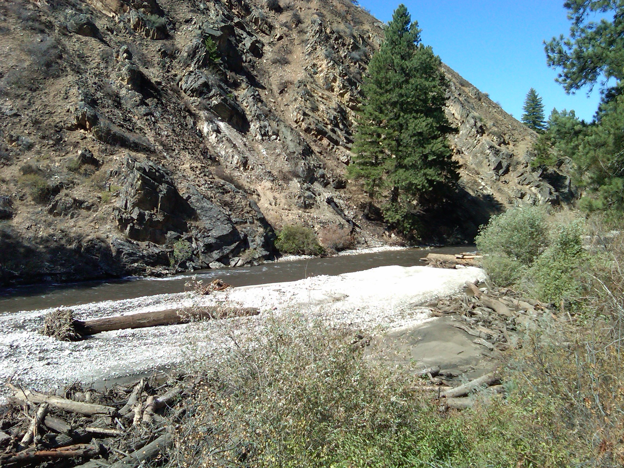
More interesting is if you compare this photo of a broader area to that take after the debris flows into the South Fork in September 2013.  Here is a photo that is trained on the conical tree on the other side of the river:

This is where the Rock Garden used to transition into the Pine Tree Hole. Photo taken September 2013.

Two things are different, three really, from these photos.  First, the sand bar evident in 2013 is less so in 2017 so some of it has washed away.  Second, the wood piled up on the bar and on the right bank is pretty much washed away into the South Fork canyon and ultimately Arrowrock Reservoir.  Third, yes there is a third thing, the flows in summer 2017 are in the range of 1,800 cfs and the flows September 16, 2013 was the first day at 300 cfs.  So this fall when the river is at 300 cfs we will go back and get some photo point updates for a more straightforward comparison.

Tagged

Sunday Trip

Sunday we took the Anderson Ranch to Prairie to Black Creeks road trip. Took a couple of pictures.

IMG_3251
Was surprised by water being released using the spill way.

IMG_3252
Water level at the main boat ramp.

IMG_3253
Met one of the locals.

IMG_3254
Decided not to go camping at this site.
Richard

Spawning in Cow Creek

Check out this video of rainbow trout spawning in Cow Creek.

Along with the video came this field dispatch:

You can see some smaller fish darting in and out around the female on the nest at 3:48, and again around the last 2 mins. I couldn’t figure out what exactly the smaller fish were doing if they were trying to get in and feed on the eggs, or fertilize the redd or what….

Highlights: redd making at 5:28, 6:32, and 7:43.

I have a few other videos of the other pairs I saw. 4 pairs total with some other males hanging around all in about 100m at the bottom of the grade. I see them in here every year but never this many and never this big.

The video runs a little over ten minutes.

Library Additions

We have a couple of new additions to the library:

  • 2015 SFB Juvenile Trout Survey – This report displays the results of the 2015 survey of age zero trout along the stream edges of the South Fork Boise River.
  • 2014 SFB Population Survey and Tributary Surveys – This report displays the results of the 2014 population survey. Typically conducted every three years, the survey was accelerated by one year to gauge the effects of the 2013 wildfire and debris flows. The document also contains information on the 2014 survey of tributaries to the South Fork, including some affected by the debris flows in 2013 and 2014.

Thanks to Idaho Fish and Game for making available their annual reports on fishery investigations.  We took the large document and extracted the relevant sections so you can review the South Fork Boise River fishery reports and not the rest of southwest Idaho’s waters.

After we take some time to delve into these reports we will come back with a reflection on what it could mean for the South Fork Boise.

Volunteer Habitat Restoration SFB April 9, 2016

WHAT: Riparian Habitat Restoration mitigating effects of Fire on the South Fork Boise with Bitterbrush and Cottonwood planting.

WHO: Interested Fishermen. We will be helping some Youth Groups out of Mtn Home who plan to come with personnel from Mtn Home Ranger District personnel.

WHEN: 10:30 am, Saturday, April 9, 2016

WHERE: Two sites on the South Fork Boise River. Arrive at Pierce Creek Boat Landing Parking Lot below Anderson Dam at beginning between 10 AM and 10:30 AM. After lunch we will all travel to Wilson Creek above the Dam.

ROUTE:  Cow Creek Road off US Hwy 20 not likely to be open. Preferred route: IH 84 to US 20; US 20 to Anderson Road turnoff; Anderson Road to Anderson Dam; Downstream on NFD 131 to Pierce Creek Boat Ramp parking lot. Plan on about two hours to arrive at Pierce Creek from the center of Boise.

DSCN2095

Uplands burned near river, August 2013

After lunch, when the selected sites are completed on the tail water, we will return upstream toward the Dam and without crossing the Dam proceed two miles along the reservoir to Wilson Creek for a second site.

BRING: (1) Your Lunch and Water; (2) A Shovel if you have one but Forest Service will have some tools available however; (3) Work Gloves. Dress appropriately, of course, for some mud and the projected weather.

RSVP: to Richard Oehlschlager right up to April 8th, sooner being better than later; richardkomd@msn.com or 208 363-0108.