Longer-term visitors to this website may recall seeing stories when the Pierce Creek Reconnection Project started and completed and the role tributaries play in maintaining a fishery.
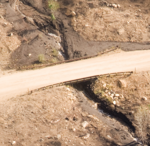
The mud and debris flows from Pierce Creek on September 12th were both substantial in amount delivered to the South Fork of the Boise River and unique in that the entire flows went under the bridge.
This was by design because when the project went forward in 2011 project engineers used data on the high flow estimates for Pierce Creek. And while not to spike the ball in the end zone or anything, it is satisfying to see something perform pretty much as planned.
But the story is not over. There could be more weather events that cause more flooding with a similar mud slurry. And there are lasting effects from the September 12 event that will need repair to the stream channel.
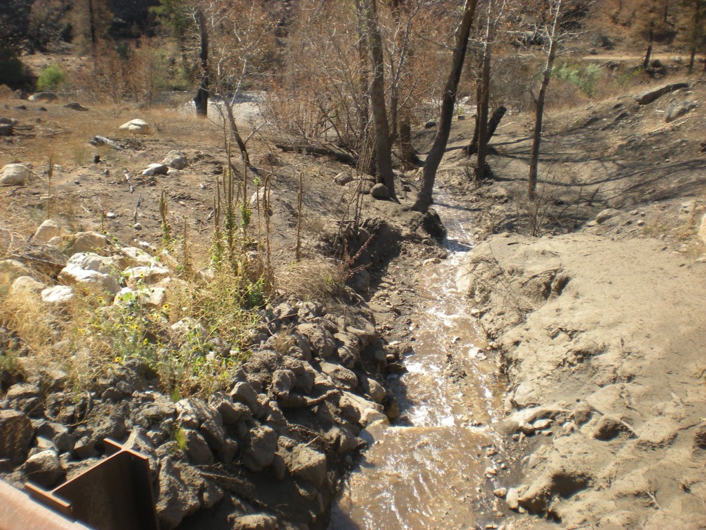
While the slurry was confined to under the bridge many of the grade control structures in the channel were swept into the river. Here is how the channel looks today:
Many boulders are covered in mud but many are also now in the South Fork of the Boise River. A large drop in the stream bed as seen in the foreground (bottom of the photo) did hold in place as that large boulder is part of the channel that was in place prior to the removal of the culvert in 2011. The vertical drop creates a barrier to fish wanting to move upstream.
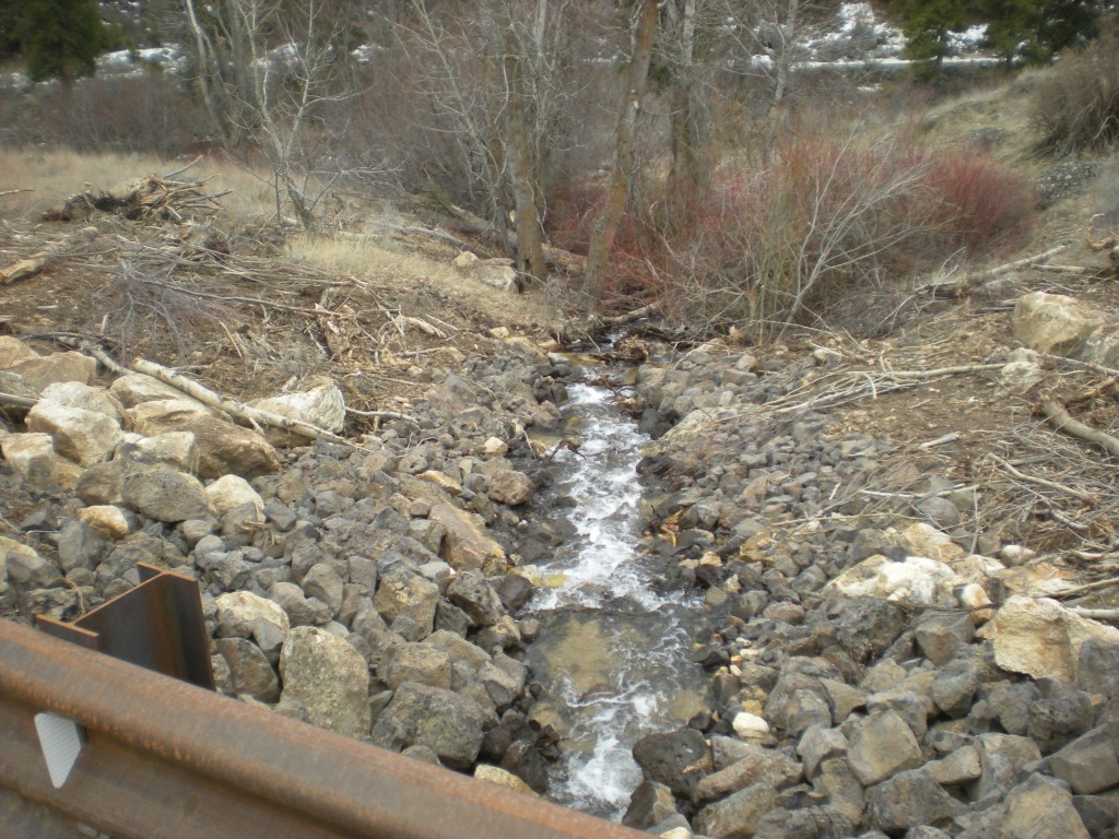
Compare the above photo with that from early 2012 just prior to planting the site:
The right bank of Pierce Creek through the trees was scoured of nearly all the brushy vegetation, brush that is clearly visible in the 2012 photo. Meanwhile the plantings on the left bank are still in place after the mud flows.
So work will be done to shore up the grade control of the stream and make it possible for fish to be able to move freely upstream and downstream in Pierce Creek. Thanks to a generous donation of time from Quadrant Consulting the field survey work will commence later this week. We salute Quadrant’s contribution to the South Fork fishery! As survey work transitions to construction we will provide updates.


One Response to AS DESIGNED: Pierce Creek Bridge Weathers the Storm